Electrical Infrastructure Information System (Grid Platform)

  • Home
  • Electrical Infrastructure Information System
image
image
About the Project

Project Overview

A registration and information system for recording substations, overhead lines, and towers of the National Electrical Transmission Network by their spatial location, managing detailed information about each facility, and organizing day-to-day operations. Each piece of equipment at substations and towers is registered, and all activities related to equipment are managed through the system.

image
Challenge

Problems to Solve

Technical & Technological:

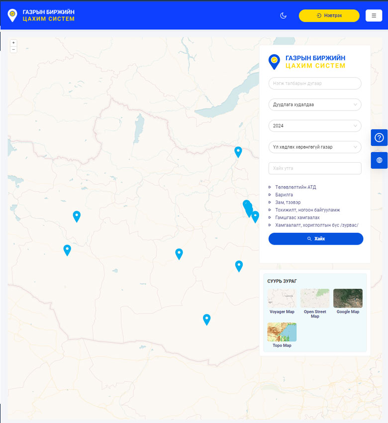
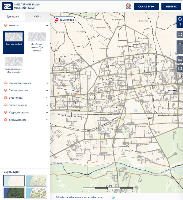
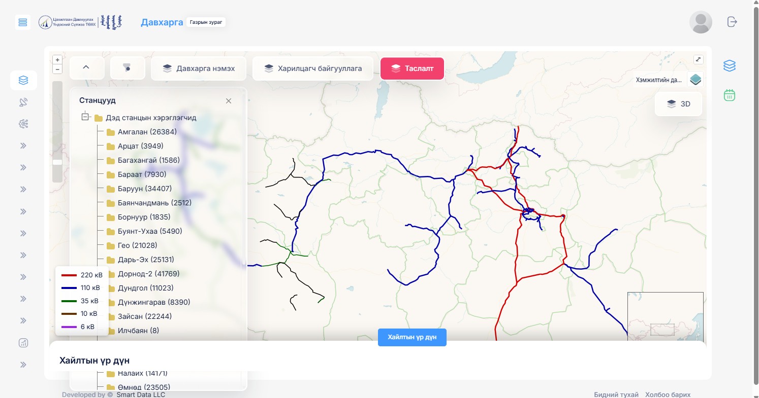
  • Enabling branch organizations of the National Electrical Transmission Network operating nationwide to access and conduct operations via a web-based internet environment
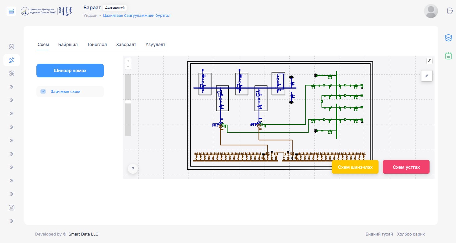
  • Ability to register each electrical infrastructure facility by its spatial location
  • Ability to map and work with substation equipment and its schematic on the web system
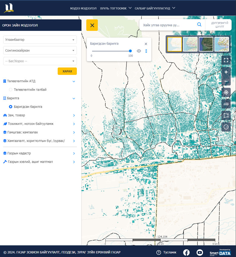
  • Viewing spatial information in both 2D and 3D on a geographic information system

Operational:

  • Creating a unified management system accessible to all staff of the National Electrical Transmission Network
  • Managing all daily operations on the system — including disconnections, interruptions, faults, orders, restrictions, load, energy balance, dispatch, and other activities
  • Enabling specialists to work directly on equipment schematics and maintain registration records
Solution

Implemented Solution

Technical & Technological:

  • Deployed our proprietary Spatial Management Integrated Platform, consistent with previously implemented systems
  • Developed web systems (Laravel Framework) and other required technologies
  • The mapping system is built on GeoServer and displayed using OpenLayers and CesiumJS technologies

Operational:

  • All electrical infrastructure facilities of the National Electrical Transmission Network have been registered with their spatial locations
  • Day-to-day operations are now recorded and managed based on electrical facilities and equipment
  • Substation equipment is now mapped and managed schematically (with support for importing from AutoCAD and QGIS)
  • Electrical facilities can be viewed on both 2D and 3D geographic systems, and overlaid with data from partner organizations (e.g., electricity distribution networks)
image
Results

Project Results

All substations, towers, and overhead lines nationwide have been registered with their spatial locations and associated information. The equipment of each electrical facility has been mapped schematically. Day-to-day operations are now conducted based on equipment and facility records.

Other Case Studies

image
General Authority for Land Management, Geodesy and Cartography

Land Management Integrated System

image
Urban Development Agency

Capital City Urban Construction System

image
General Authority for Land Management, Geodesy and Cartography

National Urban Cadastral System

image
Capital City Land Management Office

Land Auction System

image
General Authority for Land Management, Geodesy and Cartography

Land Service Kiosk Machine

Join Us

Join our team and work on exciting projects to grow your skills and expertise.

image