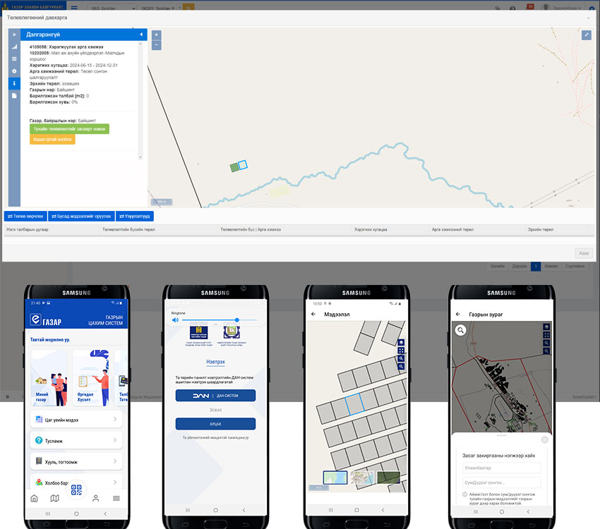
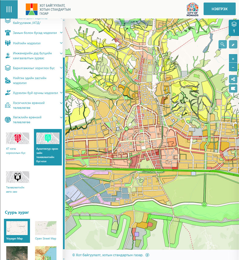
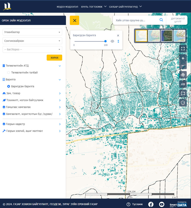
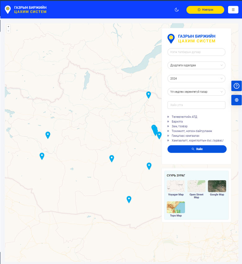
Land Management Integrated System (Land ERP)

  • Home
  • Land Management Integrated System
image
image
About the Project

Project Overview

Between 2018 and 2022, systems related to land allocation, planning, land fees, taxation, valuation, and land monitoring across Mongolia were rebuilt using updated technology. The systems we personally implemented include the Land Management System, Land Cadastre System, Land Fee/Tax/Valuation System, Land Monitoring System, as well as the public web portal and mobile application known as egazar.

image
Challenge

Problems to Solve

  • The land cadastre system operated independently at 21 provinces and 330 soums nationwide, running locally on each cadastral officer's computer.
  • Systems for land management, land fees, taxation, valuation, and land monitoring did not yet exist.
  • Information was exchanged with other agencies manually.
  • Land information could not be made publicly available.
  • Applications and requests from citizens were accepted on paper only.
  • The need to consolidate databases spread across multiple locations was identified as a key challenge to address.
Solution

Implemented Solution

  • Following the software development lifecycle, requirements and design were developed and the Land ERP system architecture was defined.
  • Development was carried out using open-source technologies in line with the client's requirements and our proposed solution.
  • A GeoServer was configured and deployed to display spatial information internally and to the public.
  • A public web portal and mobile application were built to deliver land information to citizens and to receive online requests.
  • A centralized internal management system was developed to provide nationwide access for staff.
image
Links

Project Information

Client: General Authority for Land Management, Geodesy and Cartography

Implemented: 2018 – 2022

Public portal: www.egazar.gov.mn

Mobile app: egazar

Other Case Studies

image
Urban Development and Urban Standards Agency

Capital City Urban Construction System

image
General Authority for Land Management, Geodesy and Cartography

National Urban Cadastral System

image
Capital City Land Management Office

Land Auction System

image
General Authority for Land Management, Geodesy and Cartography

Land Service Kiosk Machine

image
Capital City Road Development Agency

Capital Road and Road Infrastructure Registration System

Join Us

Join our team, work on many interesting projects and improve your skills.

image