National Urban Cadastral System (Urban State ERP)

  • Home
  • National Urban Cadastral System
image
image
About the Project

Project Overview

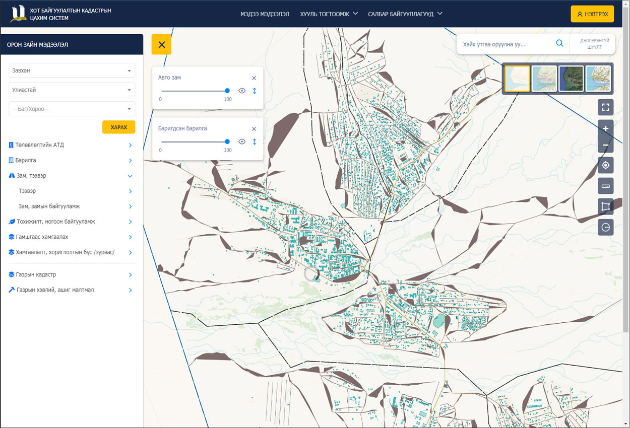
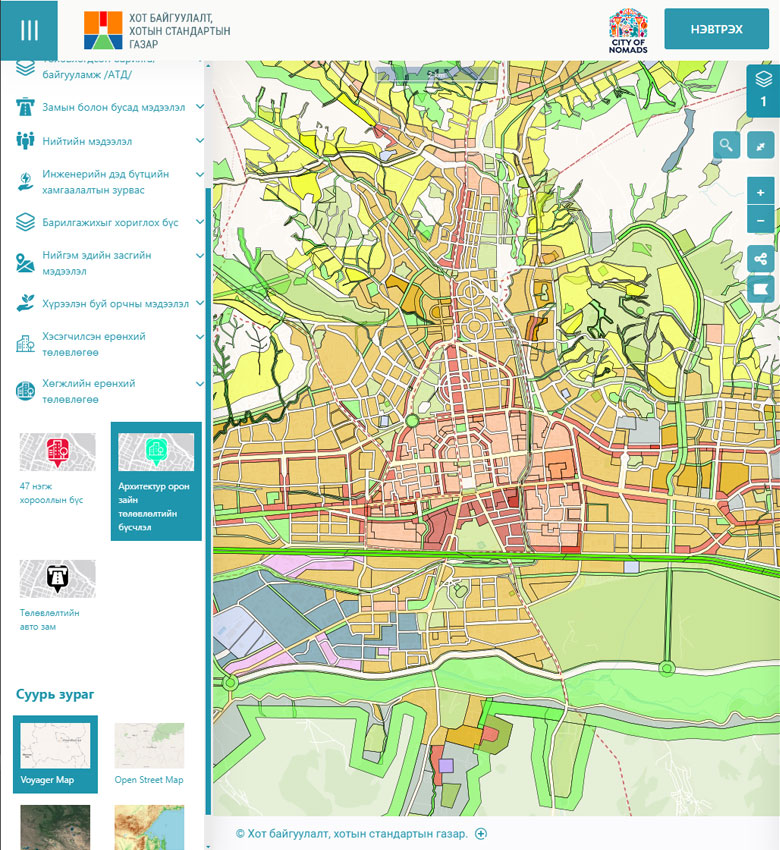
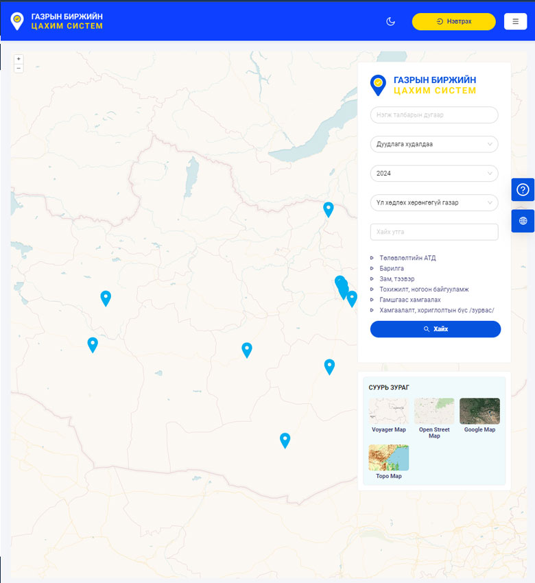
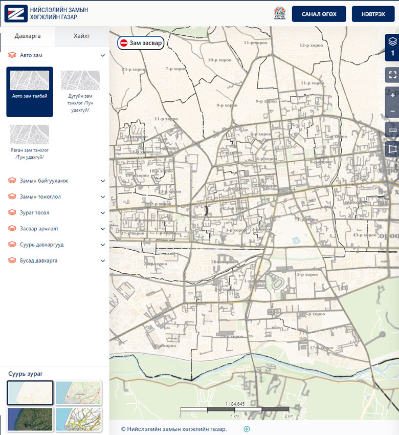
The national urban cadastre is a document on land development planning and urban construction planning and development across the country. It contains geodetic, topographic, cartographic, and hydrogeological data, urban development and land and construction information, engineering, transport, and social infrastructure data, and territorial landscaping information. The entities responsible for compiling this data are the provincial land relations and urban construction agencies. They issue construction start and continuation permits per regulations for buildings, extensions, and renovation works in their regions, record progress data, receive as-built drawings upon completion, issue Urban Construction Assessment Commission conclusions, and register other infrastructure and objects in the area with detailed information. The client needed to expand the types of spatial and non-spatial data to be registered and also to address shortcomings of the previous system and add new capabilities.

image
Challenge

Problems to Solve

  • In the old system, every time a new type of spatial or non-spatial data layer needed to be added, additional development was required and the system remained dependent on the developing company.
  • As a result, the core database structure was inflexible and non-dynamic.
  • Citizens could only submit the initial Architecture and Planning Assignment request online; all subsequent process interactions required paper-based applications, and a solution was needed to enable all construction-related requests to be submitted online.
  • The system could not connect and exchange data with required government and other agencies.
Solution

Implemented Solution

  • The problematic core database structure was redesigned and historical data was migrated to the new structure.
  • The new database structure was developed so that new registration types, service request types, and spatial data layer types can be configured without additional development — allowing the client to manage these independently.
  • Project execution involved a thorough study of user requirements and current conditions, and detailed mapping of current and future processes.
  • Software development based on system analysis reduces the risk of omitting any criteria or steps from user requirements and business operations, contributing to successful project implementation.
  • The Urban City ERP implemented at the capital level was adapted and reconfigured to create the Urban State ERP.
image
Results

Project Results

  • All types of service requests to the agency can now be received online from citizens and businesses, spatial data entered, and requests resolved.
  • New spatial data layer types can be created, and the attribute fields for those layers can be modified and configured.
  • Spatial layer colors and styles can be managed and changed from the system according to symbol standards.
  • System users are organized within the agency's organizational structure and can be reconfigured when the structure changes; access rights can be managed.
  • Service requests and operational registrations are processed through the system with validation criteria for data accuracy and completeness at each step.
  • Request and registration resolution workflows are configured per type according to internal business processes, and can be changed when the organizational structure changes — reducing future software development costs.
  • Attachments and approved documents related to requests and registrations are stored in a unified digital archive.
Links

Project Information

Client: General Authority for Land Management, Geodesy and Cartography

Funder: Ministry of Construction and Urban Development

Implemented: 2023

Public portal: www.urban.gov.mn

Mobile app: Urban: Cadastral System

Other Case Studies

image
General Authority for Land Management, Geodesy and Cartography

Land Management Integrated System

image
Urban Development and Urban Standards Agency

Capital City Urban Construction System

image
Capital City Land Management Office

Land Auction System

image
General Authority for Land Management, Geodesy and Cartography

Land Service Kiosk Machine

image
Capital City Road Development Agency

Capital Road and Road Infrastructure Registration System

Join Us

Join our team, work on many interesting projects and improve your skills.

image