Capital City Urban Construction System (Urban City ERP)

  • Home
  • Capital City Urban Construction System
image
image
About the Project

Project Overview

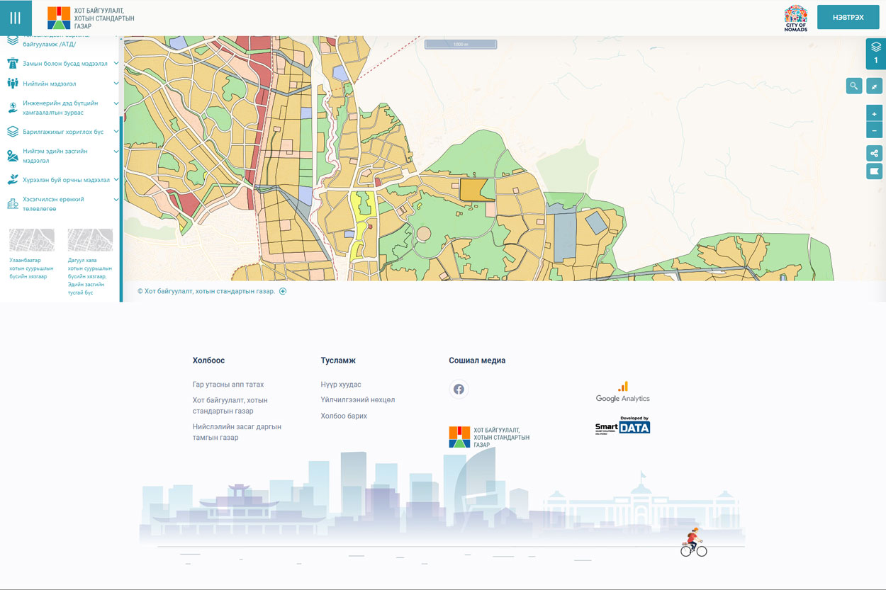
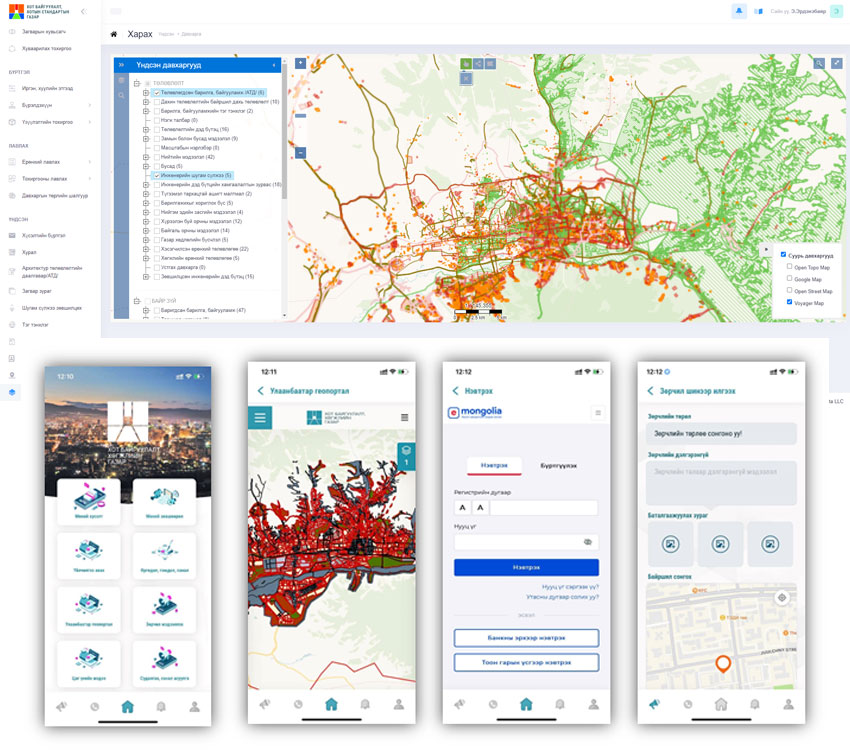
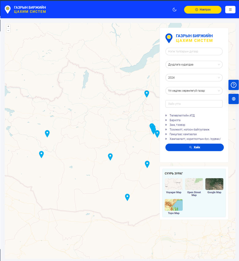
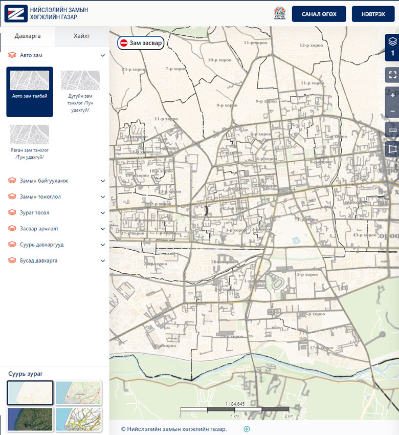
The Capital City Urban Development and Urban Standards Agency is a capital city organization responsible for organizing and approving urban planning activities in line with Mongolia's long-, medium-, and short-term development policies, planning with citizen participation based on the capital's economic and social resources, and organizing and overseeing urban construction activities using advanced modern technology to provide citizens and legal entities with fast and accessible services. Previously, the agency managed its urban construction database using desktop software and recorded spatial data in the database after processing paper-based applications from citizens.

image
Challenge

Problems to Solve

Challenges faced by citizens, businesses, and the public:

  • Difficulty viewing information about buildings constructed with or without permits.
  • No way to report unauthorized construction or urban planning violations with location-based photo documentation.
  • Submitting construction permit applications and other service requests required significant time and was paper-based only.
  • Development plans, partial master plans, and other publicly available spatial data layers were not accessible on demand.

Challenges faced by urban development agency specialists:

  • Data already stored in the system was not automatically populated, requiring manual re-entry and risking data inconsistency and wasted time.
  • Requests arriving via different systems required logging into multiple sources, causing delays and unresolved requests.
  • Documents printed from the system did not match the current format, requiring manual correction and risking transcription errors.
  • Re-entering data into multiple different systems risked inconsistent records and time loss.
  • Data standards could not be modified, and single indicator data was created in multiple conflicting ways.
Solution

Implemented Solution

The following sub-systems were created on the information systems side:

  • A web-based internal management system for organizational operations.
  • A middleware system for spatial and related data exchange with government and other agencies.
  • A file management system for storing digital documents.
  • A public web portal and mobile application for citizens and businesses.
  • A GeoServer spatial data infrastructure configured to display spatial information according to symbol standards.
  • The ability to prepare spatial mapping data in GIS software (QGIS, ArcGIS, AutoCAD) as Shapefiles and import them into the web system to populate spatial data.

Through the Urban ERP system:

  • Citizen and business requests are accepted online, automatically assigned to relevant departments, and processed with data entry.
  • Agency staff produce spatial data and documents according to standards when processing requests.
  • Approved documents are printed in standard formats from the internal management system, and related information is viewed there.
  • Citizens and businesses are notified at each step of the request resolution process.
  • Spatial and indicator data are exchanged with government and other agencies according to symbol standards.
image
Results

Project Results

  • A unified Urban ERP was created enabling all types of requests related to the Urban Development and Urban Standards Agency to be submitted and processed online, saving time and allowing citizens and businesses to submit requests and track resolution status online.
  • Citizens and businesses can log into ebarilga.ub.gov.mn via the DAN system to check whether construction is permitted on their land parcel and calculate the buildable area.
  • A unified registry of applicants, clients, contractors, and other citizens, businesses, and professional organizations related to Urban ERP operations was established.
  • Publicly available spatial data can now be viewed through the ebarilga.ub.gov.mn portal.
  • To prevent conflicts of interest among staff, all service requests are assigned by rotation or other methods, and assignment history is viewable.
  • Validation criteria for data accuracy and completeness were established.
  • Request resolution workflows are configured per service type according to internal business processes, and can be reconfigured when the organizational structure changes — reducing future software development costs.
  • Attachments and approved documents related to requests and registrations are stored in a unified digital archive.
  • New spatial data layers can be added to the database as needed, and the attribute fields for those layers can be configured without additional development.
Links

Project Information

Client: Urban Development Agency

Implemented: 2021

Public portal: www.ebarilga.ub.gov.mn

Mobile app: EBarilga

Other Case Studies

image
General Authority for Land Management, Geodesy and Cartography

Land Management Integrated System

image
General Authority for Land Management, Geodesy and Cartography

National Urban Cadastral System

image
Capital City Land Management Office

Land Auction System

image
General Authority for Land Management, Geodesy and Cartography

Land Service Kiosk Machine

image
Capital City Road Development Agency

Capital Road and Road Infrastructure Registration System

Join Us

Join our team, work on many interesting projects and improve your skills.

image